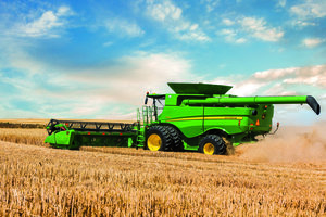
On July 7, John Deere rolled out new software for the John Deere Operations Center, offering additional features for the upcoming fall harvest.
The John Deere Operations Center will now have Tillage Maps and Speed Maps, which show how variables impact yield. It will also feature the Variety Locator, which displays information on the crop variety being harvested, directly on the in-cab display.
"This latest release is a big step forward for our precision ag solutions," said Ryan Borcherding, product manager of the John Deere Intelligent Solutions Group. "These new features, coupled with the existing abilities to share data and collaborate with trusted partners, give the farmer more reasons than ever to manage their farm data online."
Additional features include the John Deere Harvest ID, Cotton Maps, Draw Field Boundaries and Freeform Zones. The Cotton Maps show where each cotton module is harvested. With the Draw Field Boundaries and Freeform Zones features, operators can now manually draw boundaries and send them to the in-cab display of their harvesting equipment.
"Our goal is to ensure that the job in the field happens exactly as planned and is documented with minimal effort, so growers spend less time managing data and more time doing what they love – farming,” Borcherding continued.
More information on the John Deere Operations Center can be found by visiting JohnDeereOperationsCenter.com or speaking to your local John Deere dealer.